
Camera Location Surveying
The objective is to get a very accurate fix on the nodal point of the camera. It is important that the operator understands the difference between local projection systems and the ellipsoid shape of the earth. A map projection is a systematic transformation of the latitudes and longitudes of locations from the surface of a sphere or an ellipsoid into locations on a plane. Maps cannot be created without map projections. All map projections necessarily distort the surface in some fashion. Depending on the purpose of the map, some distortions are acceptable and others are not; therefore, different map projections exist in order to preserve some properties of the sphere-like body at the expense of other properties. There is no limit to the number of possible map projections.
More generally, projections are a subject of several pure mathematical fields, including differential geometry, projective geometry, and manifolds. However, “map projection” refers specifically to a cartographic projection.
In Great Britain we typically use OSGB36 projection (Northern Ireland shares the Irish Grid with the Republic of Ireland), which approximates the real-world shape of the earth as an ellipsoid and then uses a transverse Mercator projection to turn it into a 2D representation of the UK. Different ellipsoids and different projections are used in other parts of the world.
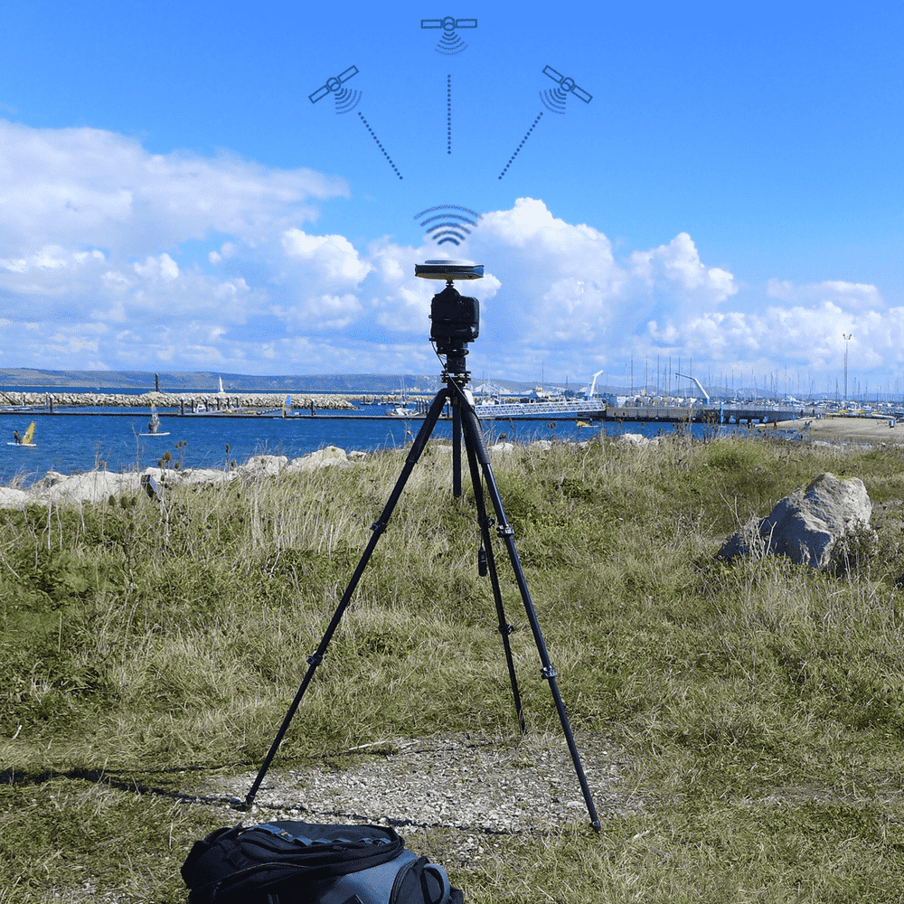
When using GPS or GNSS the data collected is generally in the local projection system, eg OSGB36. The results are given in eastings/northings and metres above Ordnance Datum.
In the UK, an ordnance datum or OD is a vertical datum used by an ordnance survey as the basis for deriving altitudes on maps. A spot height may be expressed as AOD for “above ordnance datum”. Usually mean sea level (MSL) is used for the datum. In particular: In Great Britain, OD for mainland Britain is ODN (Ordnance Datum Newlyn), defined as the MSL at Newlyn in Cornwall between 1915 and 1921. Prior to 1921, OD was taken from the level of the Victoria Dock, Liverpool (ODL). The difference between the different data varies across the country. Offshore islands often have their own datums and Northern Ireland uses the Irish datum at Malin Head.
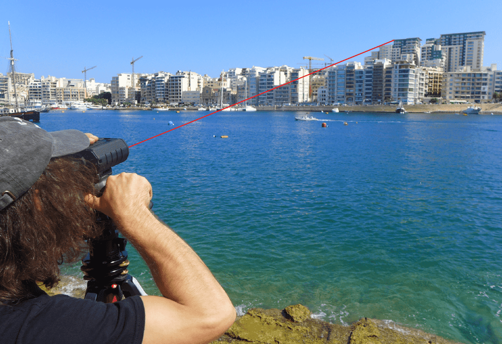
It is important to remember that the reality of the landscape photograph will not correspond with the OSGB36 projection. The photograph includes the real-world curvature of the earth and the effect of refraction through the atmosphere. Whilst this is barely perceptible at a close distance of less than km, these become increasingly more pronounced at distances above 1km. It is therefore important that the 3D modelling undertaken understands the accuracy issues of local projection systems and the effects of earth curvature and refraction.
Examples of the effects:
- 1. When stood at sea level on the beach, the maximum distance to the horizon would be less than 4km.
- 2. The Shard Tower in London would not be visible at a distance of 68 km.
- 3. A vertical lamp-post at Lands End is actually an 8.7 degree angle away from one at John O’Groats (in the vertical), purely due to the curvature of the earth.
Co-ordinates in eastings, northings and metres Above Ordnance Datum can be as accurate as 1cm using GNSS together with Real Time Kinematic (RTK) correction.
It is important that the camera/tripod location is clearly recorded, with a survey nail and clear photographs of precisely where the photographs were taken from. This will ensure that anyone who chooses to check and re-take the photographs has as clear guide when on site.